
Nelle mappe qui riportate possiamo vedere le ultime sacche di resistenza dell'Isis in territorio siriano, colorate in grigio.

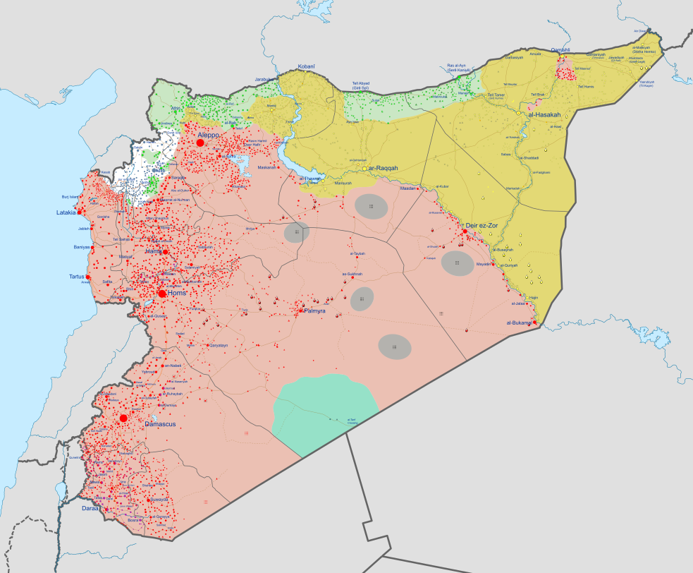
Per rendersi conto dei progressi fatti nella lotta contro lo stato islamico, basta confrontare questa mappa con quella del Califfato nello scorso settembre.

La situazione attuale mostra anche la spartizione del territorio siriano e in parte anche di quello iracheno tra le forze vincitrici e i loro alleati internazionali.

Controlled by the Syrian Arab Republic (SAA) Controlled by the Iraqi government Controlled by the Syrian Opposition Controlled by Tahrir al-Sham (HTS) Former rebel areas that have reconciled with the government Controlled by the Turkish government and Turkish-backed rebel forces Controlled by the Islamic State of Iraq and the Levant (ISIL) Controlled by the SDF Controlled by the Kurdistan Region Areas under joint SDF-SAA control Controlled by the Lebanese government Controlled by Hezbollah in Lebanon
In the respective colours: Stable mixed control Rural presence Contested Strategic hill Oilfield/Gasfield Military base or checkpoint Airport/Air base (plane) Heliport/Helicopter base Major port or naval base Border post Dam Industrial complex